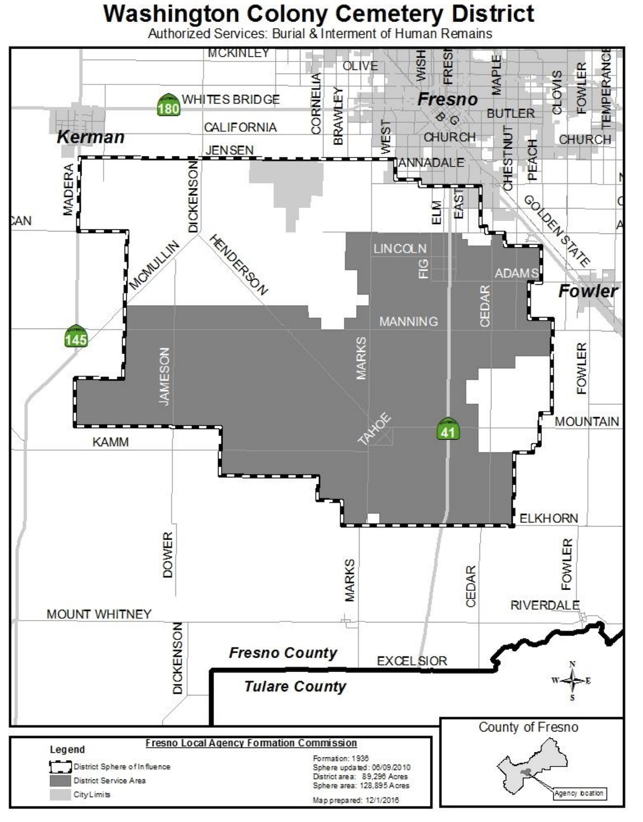
The Washington Colony Cemetery District covers approximately 89,293 acres within southwest central Fresno County. Its boundaries are generally defined by Jensen Avenue to the north, South Madera Avenue to the west, Elkhorn Avenue to the south, and South Peach Avenue to the east. The District also has a Sphere of Influence (SOI), encompassing roughly 128,895 acres, extending beyond current jurisdictional boundaries to the north and west.
Neighboring jurisdictions include Fowler Cemetery District to the east and Oak Grove Cemetery District to the south. Notably, cemetery districts do not exclusively provide burial services within their areas; therefore, private cemeteries—both religious and secular—also operate within our jurisdiction, providing families with various burial options.
Key transportation routes through the District include Highway 41, running north to south. Prominent east-west arterial streets include Jensen, Kamm, Manning, Mount Whitney, and Mountain View Avenues. Major north-south arterials within our service area include Jameson, Marks, and Cedar Avenues.
Our strategic location and extensive coverage allow us to effectively serve the communities of Caruthers, Easton, and Raisin City, ensuring accessible and dignified interment services for all residents within our District.